St. Mary’s Church Graveyard
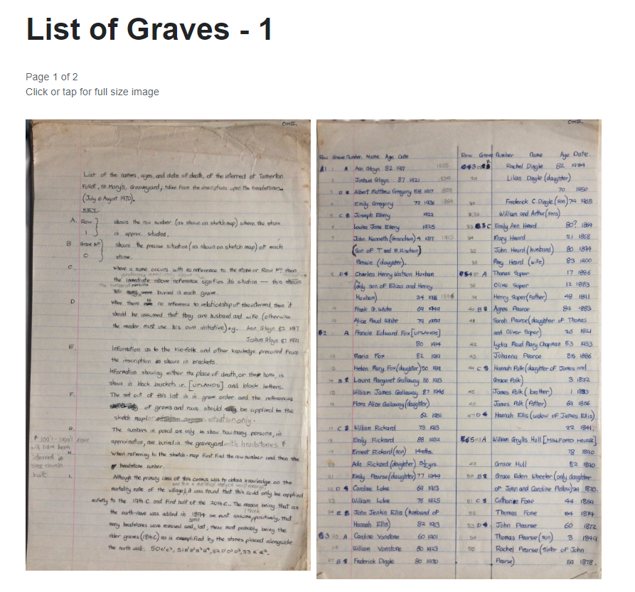
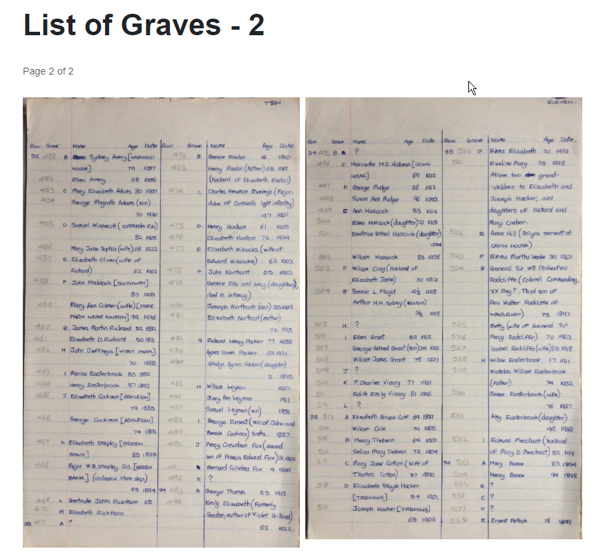
Graveyard map and record of headstone inscriptions, checked and completed during July & August 1970, by Richard Horsham, aged 18 yrs, who then lived in Budshead Road, Whitleigh.
This was one part of a school Geography Project that extended back to 1967.
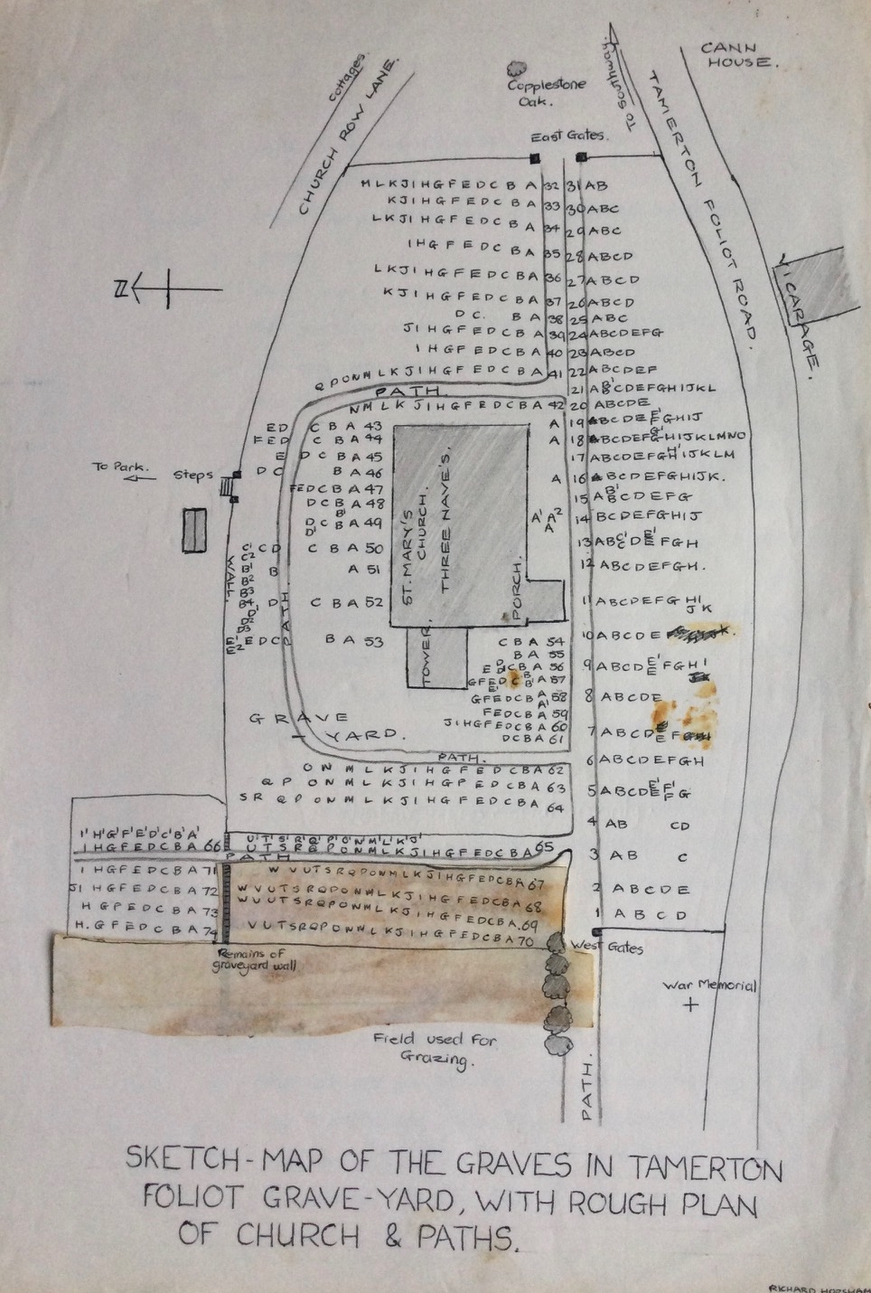
Additional notes : St.Mary’s has two side aisles and a central nave, error on sketch map ‘three naves’.
Note I below: Clarification needed – North aisle rebuilt in 1894/5, South aisle porch rebuilt, nave, aisle, porch re-roofed, church re-pewed 1849-51. These external works may well have disturbed headstones with some being moved.
The most recent internment ( dated to 1969 ) were four in 1968 ( 1162-Row 72, grave I ; 1061 Row 68, grave C ; 1025-Row 66, grave G1 ; 1026-Row 66, grave H ).
The earliest internment was in 1725, James Westcott aged 6 yrs, 626-Row 41, grave E ( East end of church, and east side of path).
– A span of 243 yrs.
Note : Originally the pencilled in numbers on the lists were to note the number of people buried, however these have been retained as they are a quick method of locating each grave using the list.
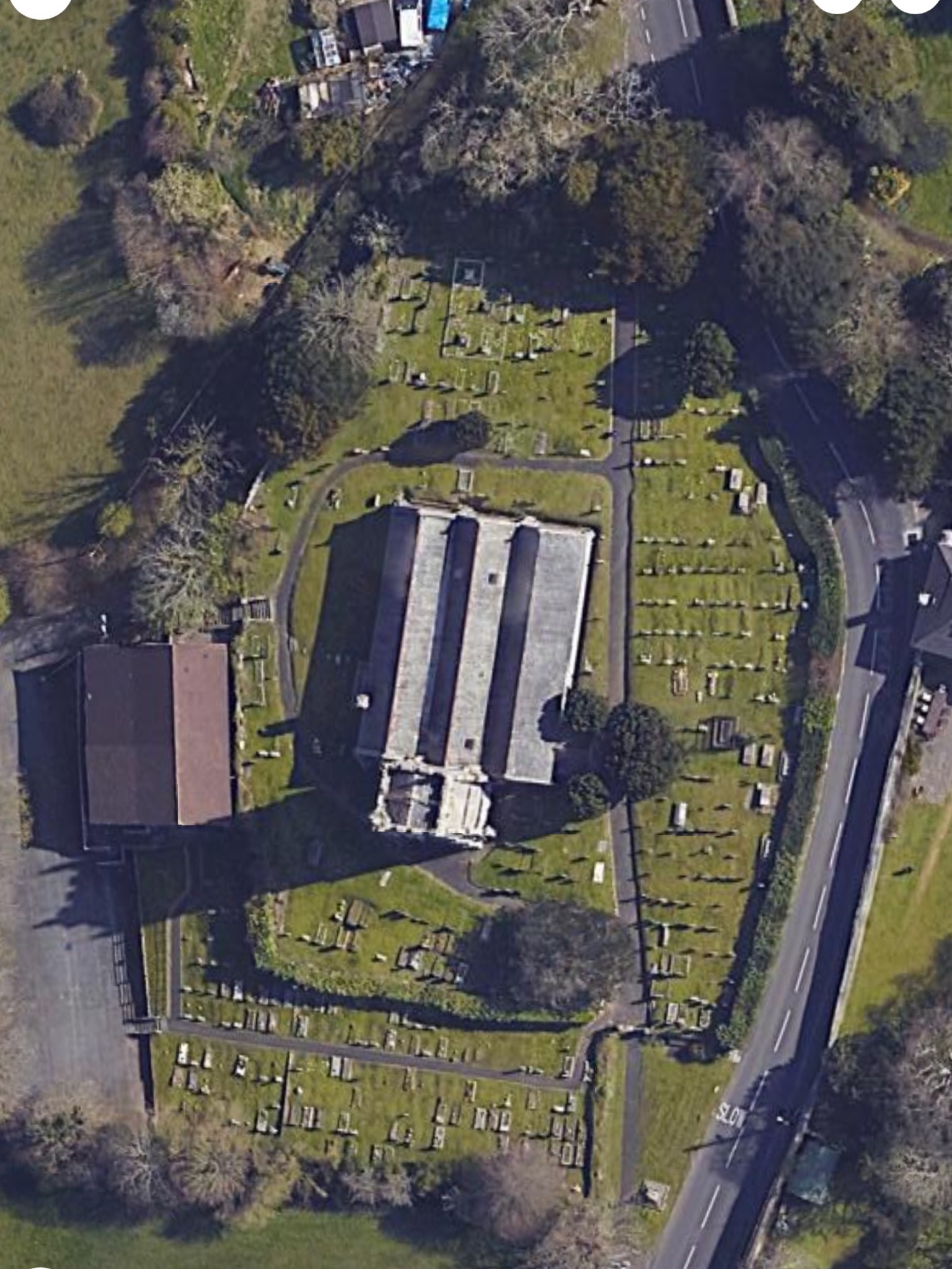
Google Earth aerial view of the church yard ( Dec.2023 ) has been included to clarify the diagrammatic plan of the grave/head stone location compared to the actual scale.